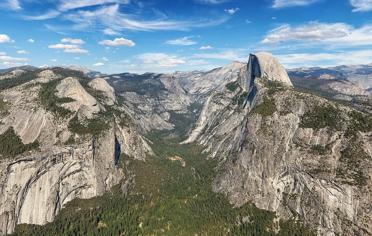
Half Dome with Eastern Yosemite Valley (50MP), Yosemite National Park

Get out of town

Day trips from Clovis

13 nearby parks, towns and places to explore, ordered by straight-line distance.

Town

Dinuba

26 miles southeast · straight-line distanceAbout 45 min by car (42 road miles, typical traffic, checked October 2026)

City in Tulare County, California, United States.

Confirm the visitor entrance, hours, reservations, access and seasonal conditions. Islands or water destinations may require different transport.
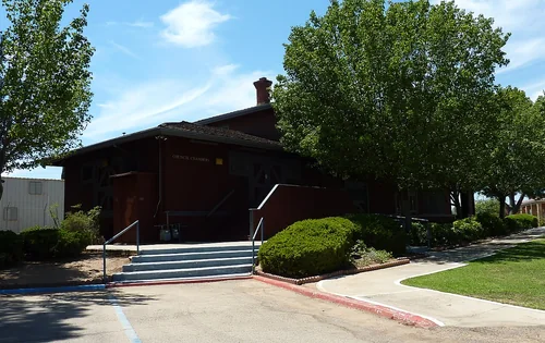
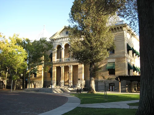
2009 0725 CA Orange Cove SFDepotTown

Orange Cove

26 miles southeast · straight-line distanceAbout 50 min by car (42 road miles, typical traffic, checked October 2026)

City in Fresno County, California, United States.

Confirm the visitor entrance, hours, reservations, access and seasonal conditions. Islands or water destinations may require different transport.
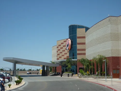
Kings County Courthouse 090407, HanfordTown

Hanford

35 miles south · straight-line distanceAbout 50 min by car (51 road miles, typical traffic, checked October 2026)

City in south-central San Joaquin Valley and the seat of Kings County, California, United States.

Confirm the visitor entrance, hours, reservations, access and seasonal conditions. Islands or water destinations may require different transport.
Tachi Palace casino entrance, LemooreTown

Lemoore

36 miles south · straight-line distanceAbout 45 min by car (40 road miles, typical traffic, checked October 2026)

City in Kings County, California, United States.

Confirm the visitor entrance, hours, reservations, access and seasonal conditions. Islands or water destinations may require different transport.
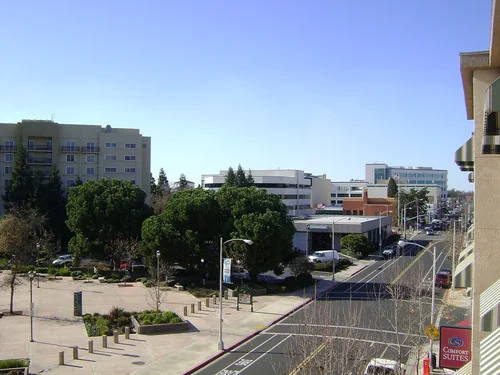
Visalia Acequia Ave.Town

Visalia

41 miles southeast · straight-line distanceAbout 50 min by car (52 road miles, typical traffic, checked October 2026)

City and county seat of Tulare County, California, United States.

Confirm the visitor entrance, hours, reservations, access and seasonal conditions. Islands or water destinations may require different transport.
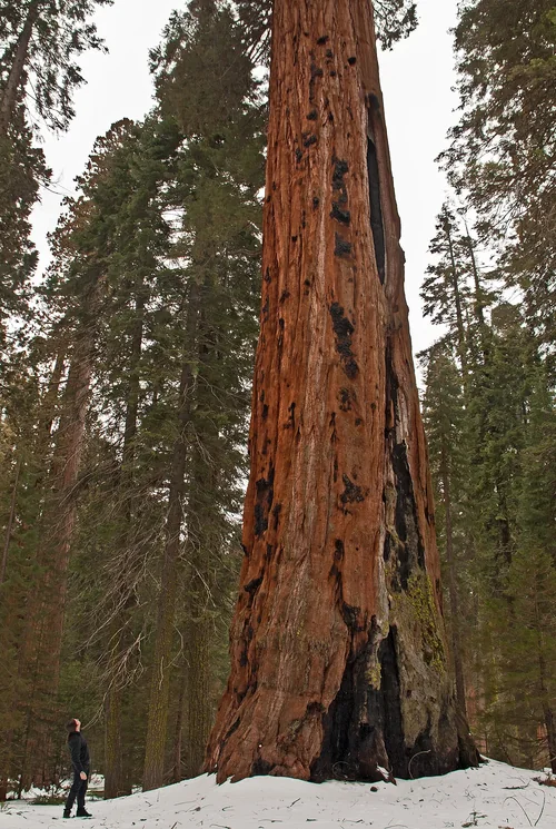
Sequoia National ParkNational park site

Sequoia National Park

55 miles east · straight-line distance

National park in the Sierra Nevada mountains, California, U.S.

Confirm the visitor entrance, hours, reservations, access and seasonal conditions. Islands or water destinations may require different transport.
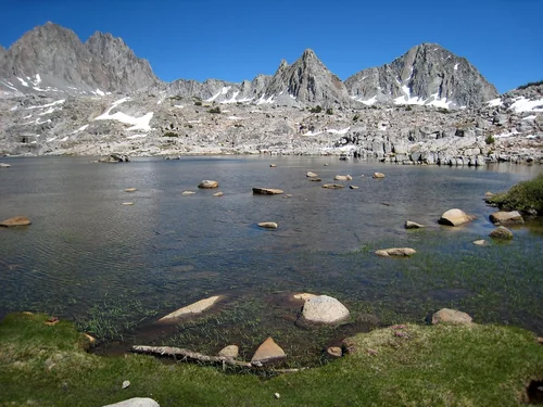
Dusy Basin in Kings Canyon, Kings Canyon National ParkNational park site

Kings Canyon National Park

57 miles east · straight-line distance

National park in the Sierra Nevada mountains in California, USA.

Confirm the visitor entrance, hours, reservations, access and seasonal conditions. Islands or water destinations may require different transport.
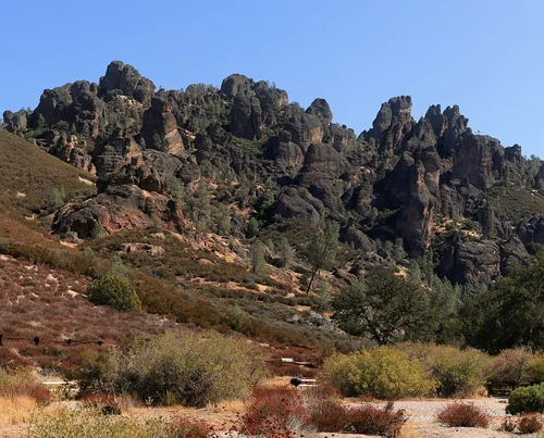
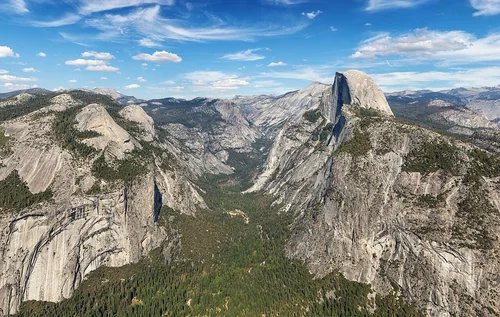
Half Dome with Eastern Yosemite Valley (50MP), Yosemite National ParkNational park site

Yosemite National Park

64 miles north · straight-line distance

National park in California, United States.

Confirm the visitor entrance, hours, reservations, access and seasonal conditions. Islands or water destinations may require different transport.
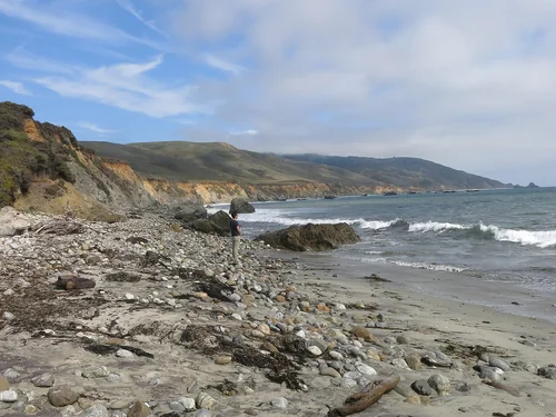
Rock formations at Pinnacles National ParkNational park site

Pinnacles National Park

84 miles west · straight-line distance

National park in California, United States of America.

Confirm the visitor entrance, hours, reservations, access and seasonal conditions. Islands or water destinations may require different transport.
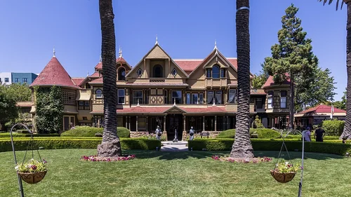
State park

Calaveras Big Trees State Park

105 miles north · straight-line distance

California state park with groves of giant sequoias.

Confirm the visitor entrance, hours, reservations, access and seasonal conditions. Islands or water destinations may require different transport.

Things to do

Gilroy Gardens

107 miles west · straight-line distanceAbout 2 hr 20 min by car (132 road miles, typical traffic, checked October 2026)

Family amusement and nature park.

Confirm the visitor entrance, hours, reservations, access and seasonal conditions. Islands or water destinations may require different transport.

Andrew Molera State ParkState park

Andrew Molera State Park

124 miles west · straight-line distance

State park in California.

Confirm the visitor entrance, hours, reservations, access and seasonal conditions. Islands or water destinations may require different transport.

Winchester Mystery HouseThings to do

Winchester Mystery House

129 miles west · straight-line distanceAbout 2 hr 40 min by car (164 road miles, typical traffic, checked October 2026)

Mansion in San Jose, California.

Confirm the visitor entrance, hours, reservations, access and seasonal conditions. Islands or water destinations may require different transport.

Driving times are typical estimates from the city center without live traffic, Powered by Geoapify · © OpenStreetMap contributors.

Distances are measured in a straight line from the city, not by road. Some older drive-time estimates have no reliable date and do not reflect current traffic; routes to large parks or waterfronts may vary. Check the destination entrance before leaving. Place descriptions come from Wikidata. Photo credits include capture dates when available; photos may not show current conditions.

Outdoor places near Clovis

40 recreation areas and campgrounds within 67 miles, from Recreation.gov. Filter by what you want to do.

Recreation area

Millerton Lake

12 miles north · straight-line distanceBureau of Reclamation

Friant Dam on the San Joaquin River, forms Millerton Lake. The dam and lake are features of the Central Valley Project - Friant Division .

BikingBoatingCampingClimbingFishingHikingHistoryHorseback riding

Campground

Aholul Group Campground

20 miles northeast · straight-line distanceAbout 50 min by car (34 road miles, checked October 2026)Bureau of Land Management

Sunset views from this site are dramatic. The group campground is one large site, which can accommodate 75+ people, and is by reservation only. There is a large, paved parking lot which can accommodate large trailers or motor homes.

BikingCampingHikingNature educationPhotographyRanger programsWildlife viewing

Campground

Equestrian Campground

20 miles northeast · straight-line distanceAbout 50 min by car (34 road miles, checked October 2026)Bureau of Land Management

Nestled by large oak trees and located near the Nuckahee Learning center, the Equestrian Campground offers a large parking area for trailers, and corrals available for horseback riders.

CampingHorse CampingHorseback riding

Campground

Pine Flat Campground

20 miles east · straight-line distanceAbout 45 min by car (34 road miles, checked October 2026)US Army Corps of Engineers

This recreation area is part of Pine Flat Lake

Camping

Recreation area

San Joaquin River Gorge Special Recreation Management Area

20 miles northeast · straight-line distanceBureau of Reclamation

The San Joaquin River Gorge SRMA is located at the upper portion of Millerton Lake and is accessed through the town of Auberry, CA. The area is managed by Bureau of Land Management (BLM) with trail heads for the San Joaquin trail.

BikingCampingClimbingFishingHikingHistoryPicnickingRanger programs

Recreation area

San Joaquin River Gorge Special Recreation Management Area

20 miles northeast · straight-line distanceBureau of Land Management

NOTICE: Between February 2nd to February 12th, high water flows and potential flow fluctuations are expected in the San Joaquin River below the Kerckhoff Dam. The BLM advises all visitors to stay out of the water during this time.

CampingHorse Camping

Recreation area

San Joaquin River Gorge Visitor Center

20 miles northeast · straight-line distanceBureau of Land Management

Visitor Center The Visitor Center is open every Friday through Sunday from 10am to 2pm. Come to the Visitor Center to explore the plants, animals and people who call the scenic San Joaquin River Gorge their home.

Nature educationRanger programsWildlife viewing

Campground

Ya-Gub-Weh-tuh Campground

20 miles northeast · straight-line distanceAbout 45 min by car (34 road miles, checked October 2026)Bureau of Land Management

Gorgeous views of the Table Mountains surround this campsite and trailhead. Camping is available on a first come-first serve basis, reservations are not accepted for this campground of six campsites with picnic tables, fire pits, and vault…

BikingCampingHikingHuntingWildlife viewing

Recreation area

Pine Flat Lake

21 miles east · straight-line distanceUS Army Corps of Engineers

Less than an hour east of Fresno in the Sierra and Sequoia National Forests. The scenic and rugged Kings River Canyon is the location of this beautiful park where fishing, boating, and waterskiing are all available.

BoatingCampingFishingHikingPicnickingWater sportsWildlife viewing

Recreation area

Hensley Lake

22 miles northwest · straight-line distanceUS Army Corps of Engineers

Less than an hour drive northeast of Fresno in the foothills of the Sierra Nevada enroute to Yosemite National Park. Lake activities include water skiing, fishing, swimming, horseback riding, mountain biking, hiking, and camping.

BoatingCampingFishingHikingNature educationPicnickingWater sportsWildlife viewing

Campground

Hidden View Campground

22 miles northwest · straight-line distanceAbout 55 min by car (37 road miles, checked October 2026)US Army Corps of Engineers

This recreation area is part of Hensley Lake

Camping

Campground

Island Park

22 miles east · straight-line distanceAbout 55 min by car (39 road miles, checked October 2026)US Army Corps of Engineers

Island Park Recreation Area is the place to go for campers looking for lots of exciting water activities at Pine Flat Lake. The area has plenty of campsites plus two group sites and a day-use area for boaters.

BoatingCampingFishingWater sports

Campground

Buck Ridge

23 miles northwest · straight-line distanceAbout 55 min by car (37 road miles, checked October 2026)US Army Corps of Engineers

Buck Ridge group day-use pavillion is located within the Buck Ridge Recreation Area at Hidden Dam, Hensley Lake.

CampingFishingHikingHorseback ridingHuntingMountain BikingPicnickingSwimming

Campground

Hidden View

23 miles northwest · straight-line distanceAbout 55 min by car (37 road miles, checked October 2026)US Army Corps of Engineers

Hidden View Campground is located at Hensley Lake in the foothills of central California, 50 miles north of Fresno.

BikingCampingHikingSwimming

Campground

Trimmer Campground

23 miles east · straight-line distanceAbout 55 min by car (30 road miles, checked October 2026)US Army Corps of Engineers

Trimmer Campground is a small facility on the shore of Pine Flat Lake in central California. Pine Flat Lake spans 20 miles in length and boasts 67 miles of shoreline.

BikingBoatingCampingFishingHikingHuntingSwimmingWater sports

Campground

Dorabelle Campground

29 miles northeast · straight-line distanceAbout 50 min by car (42 road miles, checked October 2026)USDA Forest Service

Dorabelle Campground is a popular family camping destination above Shaver Lake. Some sites are shaded by a thick stand of fir, cedar and pine trees, while other sites are more open.

BoatingCampingFishingHikingSwimmingWater sports

Campground

Wildcat Equestrian Area

30 miles northwest · straight-line distanceAbout 1 hr 15 min by car (56 road miles, checked October 2026)US Army Corps of Engineers

Wildcat Equestrian Area at Buchanan Dam, H.V. Eastman Lake is a perfect launchpad for activities like horseback riding, birding and hiking.

BikingBirdingCampingHikingHorse CampingHorseback ridingWildlife viewing

Campground

Codorniz Campground

31 miles northwest · straight-line distanceAbout 1 hr 20 min by car (57 road miles, checked October 2026)US Army Corps of Engineers

This recreation area is part of Eastman Lake

CampingFishing

Campground

Codorniz Recreation Area Campground

31 miles northwest · straight-line distanceAbout 1 hr 20 min by car (57 road miles, checked October 2026)US Army Corps of Engineers

Codorniz Campground on H.V. Eastman Lake is a perfect launchpad for activities like fishing, canoeing, birding and hiking.

BikingBoatingCampingFishingHikingHuntingRanger programsSwimming

Recreation area

Eastman Lake

31 miles northwest · straight-line distanceUS Army Corps of Engineers

Just one hour north of Fresno in the Sierra Nevada foothills. Rolling oak-covered hills provide a scenic and restful setting for fishing, boating, and hiking.

BoatingCampingFishingNature educationPicnickingWater sportsWildlife viewing

Campground

Kirch Flat Group Campground

31 miles east · straight-line distanceAbout 1 hr 35 min by car (46 road miles, checked October 2026)USDA Forest Service

At approximately 1,000 feet in elevation, Kirch Flat Campground resides on a large flat area on the river’s edge of the scenic Kings River and is surrounded by rolling, oak-covered foothills and spectacular river canyon and mountain views…

CampingFishingSwimmingWater Access

Campground

Camp Four And Half Cabin

32 miles east · straight-line distanceAbout 1 hr 40 min by car (49 road miles, checked October 2026)USDA Forest Service

Camp Four and a Half Cabin is located along the Kings River above Pine Flat Reservoir at an elevation of 1,100 feet in Sequoia National Forest.

BikingBoatingCampingFishingHikingHistoryHuntingOff Highway Vehicle Trails

Campground

Chowchilla Recreation Area Day Use

32 miles northwest · straight-line distanceAbout 1 hr 15 min by car (56 road miles, checked October 2026)US Army Corps of Engineers

Chowchilla Recreation Day Use Area is located at the beautiful Eastman Lake, surrounded by rugged oak-covered hills. Visitors take advantage of this scenic setting for fishing, boating and hiking.

BikingCampingFishingHikingSwimming

Recreation area

Fresno River Recreation Area

36 miles north · straight-line distanceBureau of Land Management

Located in the Historic Grub Gulch Mining District and site of a portion of the historic Sugarpine-Madera Flume, this site features access to the Fresno River.

FishingHikingPhotographyWildlife viewing

Recreation area

Sierra National Forest

43 miles northeast · straight-line distanceUSDA Forest Service

Fire Lookouts/Cabins OvernightHiking

Recreation area

Kaweah Lake

48 miles southeast · straight-line distanceUS Army Corps of Engineers

One hour SE of Fresno in the rugged foothills of the Sierra Nevada. High mountains provide an exciting background for fishing and boating at this popular park, located on the main southern route into Sequoia-Kings Canyon National Park.

BikingBoatingHikingNature educationPicnickingWater sportsWildlife viewing

Recreation area

Case Mountain Extensive Recreation Management Area

53 miles southeast · straight-line distanceBureau of Land Management

Nestled in the heart of the Sierra Nevada foothills, Case Mountain offers a stunning natural escape for outdoor enthusiasts.

BikingHikingHorseback ridingPicnickingWildlife viewing

Recreation area

Tumey Hills

54 miles west · straight-line distanceBureau of Land Management

Look closely at the ground you will find evidence of the vast inland sea that once covered the Tumey Hills. The light porous rocks are composed of diatoms, the tiny, bleached, shell-like skeletons of sea algae.

BikingCampingHikingHorseback ridingPhotographyWildlife viewing

Recreation area

Merced National Wildlife Refuge

56 miles northwest · straight-line distanceFish and Wildlife Service

The Merced National Wildlife Refuge encompasses 10,258 acres of wetlands, native grasslands, vernal pools, and riparian woodlands.

BirdingHikingHuntingNature educationPhotographyPicnickingWildlife viewing

Recreation area

Merced River Recreation Management Area

56 miles north · straight-line distanceBureau of Land Management

The Merced River Recreation Management Area is a very special place just downstream from Yosemite. It is well known for excellent whitewater boating, wildflower viewing, camping, swimming, and recreational gold panning/prospecting.

Accessible SwimmingBikingCampingFishingHikingPaddlingPhotographyPicnicking

Recreation area

Little Panoche Dam

61 miles west · straight-line distanceBureau of Reclamation

Little Panoche Dam is a feature of the Central Valley Project - San Luis Unit . The area is open 24 hours a day, 7 days a week. Access by foot only. Parking lot provided. Nearest main highway, I-5.

FishingHuntingPicnickingWildlife viewing

Recreation area

Sequoia & Kings Canyon National Parks

62 miles east · straight-line distanceNational Park Service

Huge mountains, rugged foothills, deep canyons, vast caverns, and the world’s largest trees exemplify the diversity of landscapes, life, and beauty here.

CampingClimbingFishingHikingHorse CampingHorseback ridingPicnickingWildlife viewing

Recreation area

Devils Postpile National Monument

64 miles northeast · straight-line distanceNational Park Service

Established in 1911 by presidential proclamation, Devils Postpile National Monument protects and preserves the Devils Postpile formation, the 101-foot high Rainbow Falls, and pristine mountain scenery.

CampingFishingHikingWildlife viewing

Recreation area

Griswold Hills

65 miles west · straight-line distanceBureau of Land Management

Within the steep and rugged Griswold Canyon, BLM land straddles both sides of the road.

BikingCampingHikingHorseback ridingHuntingPhotographyWildlife viewing

Recreation area

Panoche Hills

65 miles west · straight-line distanceBureau of Land Management

BikingCampingHikingHuntingPhotographyWildlife viewing

Recreation area

Pixley National Wildlife Refuge

65 miles south · straight-line distanceFish and Wildlife Service

Visitors to the Pixley National Wildlife Refuge may be surprised to see that it is home to small, seasonal marsh wetlands.

BirdingHikingPhotographyWildlife viewing

Recreation area

San Luis National Wildlife Refuge

65 miles west · straight-line distanceFish and Wildlife Service

The San Luis National Wildlife Refuge encompasses over 26,800 acres of wetlands, riparian woodlands, native grasslands, and vernal pools. A thriving population of endemic tule elk is showcased on one of three auto tour routes.

BirdingFishingHikingHuntingPhotographyPicnickingWildlife viewing

Recreation area

Condon Peak

66 miles southwest · straight-line distanceBureau of Land Management

Located on the outskirts of the Clear Creek Management Area (CCMA), Condon Peak offers rolling grass-covered slopes with a few tall pines and shrubs, as well as steep slopes and rocky outcrops covered with pine and brush.

BikingCampingHikingHorseback ridingPhotographyWildlife viewing

Recreation area

Coalinga Mineral Springs

67 miles southwest · straight-line distanceBureau of Land Management

The Coalinga Mineral Springs National Recreation Trail was designated under the National Recreation Trails System Act in 1981. The trail is located on the scenic southern tip of the Diablo Mountains.

BikingCampingHikingHorseback ridingHuntingPhotographyWildlife viewing

Recreation area

Curry Mountain

67 miles southwest · straight-line distanceBureau of Land Management

Parking access onto nearly 1,800 acres of Bureau of Land Management property in this area is provided through an easement from the California Department of Fish and Game.

BikingCampingHikingHorseback ridingHuntingPhotographyWildlife viewing

Recreation areas and campgrounds from Recreation.gov's directory, checked October 9, 2026. Listings are not live availability: check Recreation.gov or the managing agency for open dates, fees, reservations and conditions. Directions go to the listed coordinates, which may not be the entrance. Campground driving times: Powered by Geoapify · © OpenStreetMap contributors.

Questions

What day-trip ideas are near Clovis?

This guide includes Dinuba, Orange Cove, Hanford, Lemoore, Visalia. Places are ordered by straight-line distance. Confirm visitor access, opening hours and current travel conditions before choosing a trip.

How far is Dinuba from Clovis?

Approximately 26 miles southeast in a straight line; driving takes about 45 min over 42 road miles in typical traffic (Geoapify, checked October 2026). This is not current traffic or a route to a confirmed visitor entrance. Check your route before leaving.

How far is Orange Cove from Clovis?

Approximately 26 miles southeast in a straight line; driving takes about 50 min over 42 road miles in typical traffic (Geoapify, checked October 2026). This is not current traffic or a route to a confirmed visitor entrance. Check your route before leaving.

How far is Hanford from Clovis?

Approximately 35 miles south in a straight line; driving takes about 50 min over 51 road miles in typical traffic (Geoapify, checked October 2026). This is not current traffic or a route to a confirmed visitor entrance. Check your route before leaving.

Where can I camp near Clovis?

Recreation.gov lists 16 campgrounds within 32 miles, including Aholul Group Campground (20 miles northeast), Equestrian Campground (20 miles northeast), Pine Flat Campground (20 miles east). Check Recreation.gov for current availability, seasons and reservations.

Clovis AI

Your Clovis local guide
Hey there!

I'm Clovis AI. Ask about neighborhood food, independent shops, local history or planning a visit.

AI recommendations may be inaccurate. Verify hours and prices. Questions are processed by Cloudflare. Privacy