Millerton Lake
12 mi north · Bureau of Reclamation
Friant Dam on the San Joaquin River, forms Millerton Lake. The dam and lake are features of the Central Valley Project - Friant Division .
Outdoors
Lakes, rivers and recreation areas near Clovis where fishing is allowed, closest first.
Good to know: Anyone 16 or older generally needs a state fishing license; seasons, limits and special rules vary by water. California license information ↗
12 mi north · Bureau of Reclamation
Friant Dam on the San Joaquin River, forms Millerton Lake. The dam and lake are features of the Central Valley Project - Friant Division .
20 mi northeast · Bureau of Reclamation
The San Joaquin River Gorge SRMA is located at the upper portion of Millerton Lake and is accessed through the town of Auberry, CA. The area is managed by Bureau of Land Management (BLM) with trail heads for the San Joaquin trail.
21 mi east · US Army Corps of Engineers
Less than an hour east of Fresno in the Sierra and Sequoia National Forests. The scenic and rugged Kings River Canyon is the location of this beautiful park where fishing, boating, and waterskiing are all available.
Map of 20 places loads as you scroll.
Friant Dam on the San Joaquin River, forms Millerton Lake. The dam and lake are features of the Central Valley Project - Friant Division .
The San Joaquin River Gorge SRMA is located at the upper portion of Millerton Lake and is accessed through the town of Auberry, CA. The area is managed by Bureau of Land Management (BLM) with trail heads for the San Joaquin trail.
Less than an hour east of Fresno in the Sierra and Sequoia National Forests. The scenic and rugged Kings River Canyon is the location of this beautiful park where fishing, boating, and waterskiing are all available.
Less than an hour drive northeast of Fresno in the foothills of the Sierra Nevada enroute to Yosemite National Park. Lake activities include water skiing, fishing, swimming, horseback riding, mountain biking, hiking, and camping.
Island Park Recreation Area is the place to go for campers looking for lots of exciting water activities at Pine Flat Lake. The area has plenty of campsites plus two group sites and a day-use area for boaters.
Buck Ridge group day-use pavillion is located within the Buck Ridge Recreation Area at Hidden Dam, Hensley Lake.
Trimmer Campground is a small facility on the shore of Pine Flat Lake in central California. Pine Flat Lake spans 20 miles in length and boasts 67 miles of shoreline.
Dorabelle Campground is a popular family camping destination above Shaver Lake. Some sites are shaded by a thick stand of fir, cedar and pine trees, while other sites are more open.
This recreation area is part of Eastman Lake
Codorniz Campground on H.V. Eastman Lake is a perfect launchpad for activities like fishing, canoeing, birding and hiking.
Just one hour north of Fresno in the Sierra Nevada foothills. Rolling oak-covered hills provide a scenic and restful setting for fishing, boating, and hiking.
At approximately 1,000 feet in elevation, Kirch Flat Campground resides on a large flat area on the river’s edge of the scenic Kings River and is surrounded by rolling, oak-covered foothills and spectacular river canyon and mountain views…
Camp Four and a Half Cabin is located along the Kings River above Pine Flat Reservoir at an elevation of 1,100 feet in Sequoia National Forest.
Chowchilla Recreation Day Use Area is located at the beautiful Eastman Lake, surrounded by rugged oak-covered hills. Visitors take advantage of this scenic setting for fishing, boating and hiking.
Located in the Historic Grub Gulch Mining District and site of a portion of the historic Sugarpine-Madera Flume, this site features access to the Fresno River.
The Merced River Recreation Management Area is a very special place just downstream from Yosemite. It is well known for excellent whitewater boating, wildflower viewing, camping, swimming, and recreational gold panning/prospecting.
Little Panoche Dam is a feature of the Central Valley Project - San Luis Unit . The area is open 24 hours a day, 7 days a week. Access by foot only. Parking lot provided. Nearest main highway, I-5.
Huge mountains, rugged foothills, deep canyons, vast caverns, and the world’s largest trees exemplify the diversity of landscapes, life, and beauty here.
Established in 1911 by presidential proclamation, Devils Postpile National Monument protects and preserves the Devils Postpile formation, the 101-foot high Rainbow Falls, and pristine mountain scenery.
The San Luis National Wildlife Refuge encompasses over 26,800 acres of wetlands, riparian woodlands, native grasslands, and vernal pools. A thriving population of endemic tule elk is showcased on one of three auto tour routes.
Distances are straight-line miles from downtown Clovis. Listings come from Recreation.gov’s federal recreation database; check each official page for hours, fees, fire restrictions and closures before you go.

THINGS TO DO · YOUTUBE SHORT
A local activity Short shared by Kblz AI.
Watch on YouTube ↗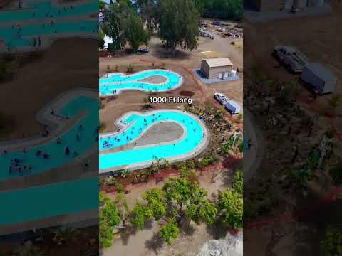
THINGS TO DO · YOUTUBE SHORT
A local activity Short shared by Wild Water Adventure Park.
Watch on YouTube ↗


Millerton Lake (Bureau of Reclamation), about 12 miles north of Clovis as the crow flies. Next are San Joaquin River Gorge Special Recreation Management Area (20 mi) and Pine Flat Lake (21 mi).
Yes, anglers 16 and older generally need a California fishing license from the state wildlife agency. Rules, seasons and limits vary by water.
Federal agencies including US Army Corps of Engineers, Bureau of Reclamation, USDA Forest Service. Each listing links to its official page for hours, fees, closures and current conditions.